
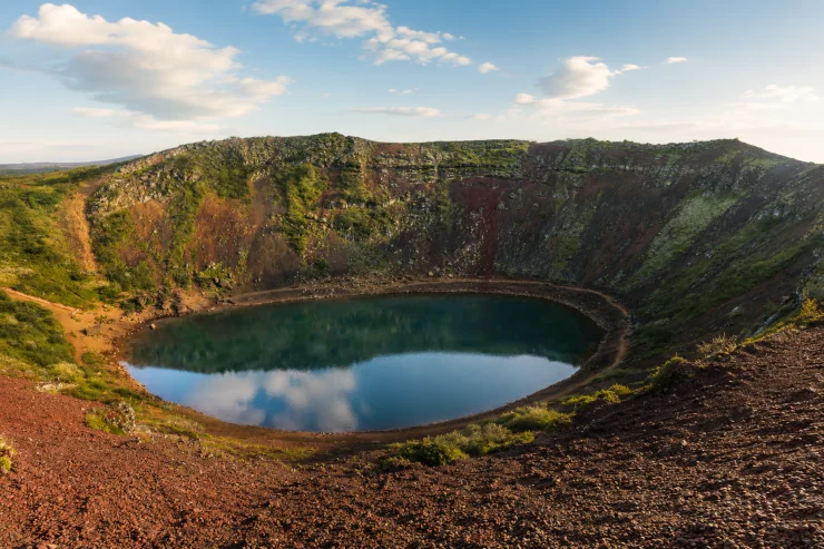
Kerið is a volcanic crater lake in the Grímsnes area of southwest Iceland, and it sits along the well-known Golden Circle route.
It stands out because of its colors: deep red walls, patches of green moss, and a bright aquamarine lake at the bottom.
The crater is young in geological terms, formed somewhere between 3,000 and 6,500 years ago.
It belongs to Iceland’s Western Volcanic Zone, the same volcanic system that includes the Reykjanes Peninsula and the Langjökull glacier. Kerið is the northernmost of four craters in a chain called Tjarnarhólar.
What makes Kerið different from many other craters is how it formed. It was not caused by a violent explosion. Instead, a cone volcano erupted and emptied out its magma below the surface.
Once the magma chamber was empty, the ground above had nothing to support it, so it collapsed inward and left the bowl shape we see today. Geologists call this kind of collapse a caldera.
The crater walls are made of basalt and scoria, a light, full-of-holes type of rock rich in iron. Because Kerið is still geologically young, the iron in the rock has not fully rusted yet, which is why the walls look red instead of the usual black seen in older Icelandic craters.
At the bottom sits a lake, usually somewhere between 7 and 14 meters deep depending on the season.
The water level rises and falls with the underground water table, not with rain, since Kerið has no rivers flowing in or out. The bright blue-green color of the water comes from minerals in the surrounding volcanic rock reacting with the water.
The crater itself measures about 55 meters deep, 170 meters wide, and 270 meters across.
A path runs completely around the rim, giving wide views over the lake and the layered red rock below. A staircase leads down from the rim to the water’s edge for those who want a closer look, though the steps can get slippery in winter.
Kerið is privately owned land, so visitors pay a small entrance fee, which helps maintain the site. Parking, restrooms, and the walking paths are all included with the ticket.
The area around Kerið is part of a wider region full of craters and old lava fields, a reminder that this land was shaped again and again by volcanic activity long after the ice sheets melted.
Even without knowing the geology, most visitors notice right away how strange and layered the place looks: red rock, green moss, and blue water sitting together inside what was once a chamber of molten rock beneath the earth.
This page contains affiliate links, which may earn us a small commission at no extra cost to you.