When Sicily became an island is a story written in fire, water, and deep time.
It’s hard to imagine now, standing on a sun-baked Sicilian cliff, that the turquoise water glittering below once wasn’t there. That where the Strait of Messina now swirls with treacherous currents, there may once have been a valley, dry and green, linking Sicily to the Italian mainland; or that this island, home to Etna’s smoldering fury and Palermo’s baroque splendor, was once just a piece of Africa slowly colliding with Europe.
But that’s exactly what Sicily is: a geological refugee, born from chaos. Its history is not merely ancient. It’s deep time, written in rock, salt, and ash.
Table of Contents
The Restless Heart of the Mediterranean
To understand when Sicily became an island, you first have to imagine a Mediterranean that didn’t look anything like the one on today’s maps.
Go back about 100 million years, and what is now the Mediterranean was an ocean — part of the mighty Tethys Sea, stretching between the drifting continents of Gondwana and Laurasia. Africa was on the move, inching northward toward Europe. Between them lay fragments of crust, microcontinents, and submerged platforms — bits of what would one day become Sicily, Calabria, and the Apennines.
Geologists describe it as a tectonic traffic jam. The African plate was diving under the Eurasian one, crumpling and folding layers of seafloor, pressing them upward into mountain ranges. The result was a patchwork of land and sea, a jigsaw of rising and sinking blocks.
Some of those blocks (like the Hyblean Plateau in southeastern Sicily) were part of the African plate. Others, such as the rugged Peloritani Mountains in the northeast, have a completely different origin. According to research by Italy’s National Institute of Geophysics and Volcanology (INGV), the mountains of northeastern Sicily were once part of the ancient Iberian landmass — essentially carried eastward across the sea on a geological conveyor belt. In other words, part of Sicily’s crust has its origins in what is now Spain.
Mountains From the Deep
By the Oligocene Epoch, around 30 million years ago, the slow-motion collision between Africa and Europe was sculpting the landscape we now call Sicily. The sea shallowed, new land rose, and vast coral platforms flourished where deep waters had once been.
But it wasn’t yet an island. It was a tangle of peninsulas and basins, connected here, submerged there: a restless landscape constantly reworked by the planet’s internal machinery.
Then came the Miocene, a period of extraordinary upheaval. Around 10 to 7 million years ago, parts of Sicily began to lift higher above sea level, while others sank. Great mountain chains — the Madonie, Nebrodi, and Peloritani ranges — were pushed skyward as the crust buckled. Rivers carved valleys; volcanic arcs formed offshore.
At times, Sicily may have been split into multiple smaller islands, separated by shallow seas and lagoons. At others, it may have been part of the mainland, a peninsula jutting out from what is now Calabria. The geography was as fluid as the magma simmering below it.
One episode stands out in this ancient drama — the Messinian Salinity Crisis, around 6 million years ago. The Mediterranean, cut off from the Atlantic, almost dried out. Vast salt flats covered the seabed. The island question becomes moot here: the whole Mediterranean nearly vanished. When the ocean returned about 5.3 million years ago, in what scientists call the Zanclean Flood, it refilled the basin in a cataclysmic rush. Water thundered through the reopened Strait of Gibraltar, carving channels, flooding valleys, and reshaping coastlines across southern Europe, including Sicily’s.
When the Mediterranean was reborn, so was Sicily’s destiny as an island.
Sicily tells the story of the Mediterranean better than any other place.
Earthquakes, Volcanoes, and the Birth of Separation
The story, though, wasn’t over. Even as the seas returned, the land continued to shift. The boundary between the African and Eurasian plates didn’t stop moving; it just changed style: from collision to grinding.
Along Sicily’s northeastern edge, near modern Messina, the crust began to tear apart. Faults opened, blocks dropped, and the land fractured. The result was the Strait of Messina, the narrow, turbulent channel that today separates Sicily from mainland Italy.
No one can say with certainty when this strait first filled with seawater for good. But geological evidence suggests that it became a consistent marine passage sometime during the Quaternary Period, within the last million years. Before that, it may have opened and closed several times as sea levels rose and fell with the ice ages.
During glacial maxima, when ice sheets locked up enormous amounts of water and global sea levels dropped by more than 100 meters, the Sicilian shelf might have been exposed. For thousands of years at a time, it’s possible that early humans and animals could walk across what is now the seabed, migrating between the island and the mainland.
Then, as the ice melted, the sea would rise again, turning peninsulas into islands, valleys into straits, and travelers into castaways.
The Island Takes Its Final Shape
Sometime between 800,000 and 500,000 years ago, Sicily likely took on its modern outline. The Strait of Messina deepened, subsidence accelerated, and water flooded in permanently. From that moment onward, Sicily was a true island; not a peninsula, not a cluster of temporary land bridges, but a self-contained world surrounded by sea.
The forces that defined its separation didn’t stop there. Even today, the island is alive with motion. The crust continues to flex; the faults that created the Messina Strait are still active. Earthquakes rattle the region with unnerving regularity — the most devastating in 1908 flattened Messina itself.
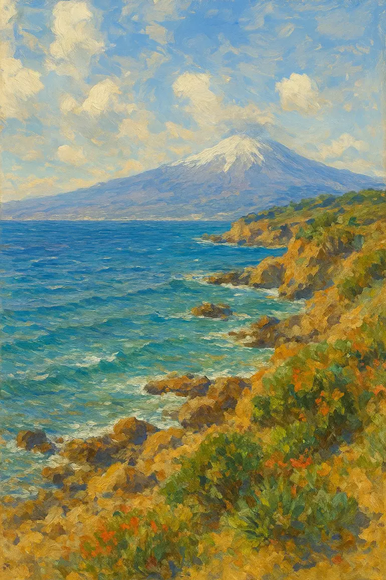
Meanwhile, Mount Etna, Europe’s largest active volcano, continues to grow. It rises on Sicily’s eastern flank like a warning from the underworld, spewing lava and ash from deep within the Earth’s mantle. Etna’s eruptions are not just spectacular; they are reminders that Sicily’s story is still being written in fire.
Land of Collision
What makes Sicily’s geology so extraordinary is its position at a crossroads — not just cultural, but continental. The island is a mosaic of two worlds: the African and the European. The northern half belongs to the “Maghrebian chain,” a continuation of the North African mountain belt. The southern half, by contrast, sits firmly on the African plate. In a sense, the island itself is a microcosm of the entire Mediterranean collision zone.
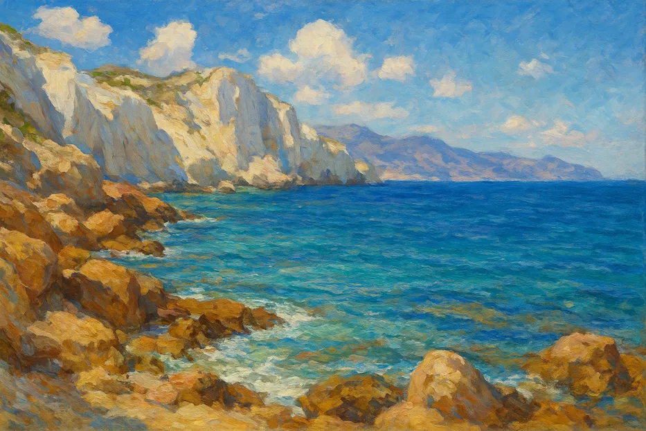
That dual identity is visible everywhere. The soft limestone cliffs of the south (like the dazzling white Scala dei Turchi near Agrigento) tell of ancient marine deposits lifted high above sea level. The rugged mountains of the north, meanwhile, preserve metamorphic rocks born deep underground, remnants of a time when Sicily’s crust was crushed under enormous pressure.
Between them, volcanic arcs and sedimentary basins record millions of years of change: rising seas, sinking valleys, the opening and closing of channels, the relentless dance between fire and water.
The Sea That Made the Island
Ironically, it was the sea — the very force that separates Sicily — that also helped define its life and culture. Once it became isolated, its ecosystems evolved independently. Species that had crossed over before the final separation (like dwarf elephants, giant deer, and endemic shrews) were stranded, evolving along unique paths.
For archaeologists and paleontologists, Sicily is a natural laboratory, preserving evidence of both geological and biological evolution. Bones of prehistoric elephants and hippos lie buried in caves once close to freshwater rivers that no longer exist. Fossils of corals, mollusks, and diatoms reveal shifts in ancient shorelines.
And above it all, human history began to unfold. By around 17,000 years ago, early peoples were crossing or sailing short distances between the Italian mainland and Sicily, leaving behind stone tools and cave art. The sea that once was a barrier became a highway.
A Living Laboratory of Earth’s Past
Today, Sicily remains one of the most dynamic regions in the Mediterranean. The island moves a few millimeters every year: slowly rotating, shifting, rising in places and sinking in others. Satellite measurements confirm it: the geological forces that made Sicily an island are still active.
For scientists, that makes it a perfect natural observatory. It’s where Africa meets Europe, literally. Every earthquake, every volcanic eruption is a reminder that the process never stopped.
Standing on the slopes of Etna at sunset, you can feel that energy. The land trembles faintly, and the air smells of sulfur and sea. Far below, the Strait of Messina glints like a scar dividing two worlds: a reminder that islands are not born peacefully. They are torn from the Earth, shaped by heat and water and time.
From Chaos to Beauty
Sicily’s geological past is a saga of collision and creation, of oceans disappearing and mountains rising, of continents kissing and parting. It is a land forged in slow catastrophe, its beauty inseparable from its violence.
And the answer to when it became an island? It’s not a single moment; it’s a million-year journey. From the uplift of ancient seabeds to the birth of the Messina Strait, Sicily’s isolation was gradual, episodic, and alive with drama. By the time humans first gazed across that narrow strip of water, the island had already earned its identity: a jewel cut by tectonic hands.
Today, Sicily stands as a reminder of the Earth’s restlessness: a fragment of Africa adrift beside Europe, an island born of upheaval, and a living testament to the power of time.