The island of Ireland has one of Europe’s most remarkable geological histories. Long before Celtic legends, medieval castles, or even the first forests appeared, powerful natural forces were shaping the land beneath our feet.
The oldest rocks exposed on the island of Ireland date back around 1.7 billion years. These ancient rocks, discovered in County Donegal and on Inishtrahull Island off the northern coast, formed during a time when Earth looked completely different from today. They are among the oldest rocks in western Europe and provide a remarkable glimpse into the planet’s distant past.
That doesn’t mean the whole island is 1.7 billion years old. Ireland wasn’t created all at once. Instead, the land that now forms the island developed over hundreds of millions of years as ancient continents drifted across the globe, oceans opened and closed, mountains rose, volcanoes erupted, and rivers slowly reshaped the landscape. The modern island of Ireland is the result of an extraordinary geological journey that spans almost half of Earth’s history.
This page may contain affiliate links.
Ireland Was Once South of the Equator
It’s difficult to imagine today’s green countryside as a tropical paradise, but that’s exactly what much of Ireland was during the Carboniferous Period, around 340 million years ago.
At that time, Ireland lay much closer to the equator. Warm, shallow seas covered large areas of the land, creating ideal conditions for coral reefs, shellfish, crinoids, and countless other marine creatures. When these organisms died, their shells settled on the seabed and gradually built up thick layers of calcium-rich sediment.
Over millions of years, pressure transformed those deposits into limestone. Today, Carboniferous limestone covers much of central Ireland and is responsible for many of the country’s distinctive landscapes.
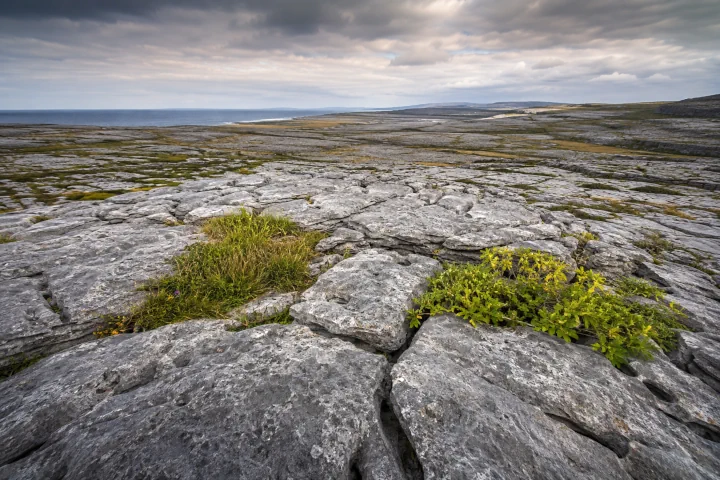
Perhaps the best-known example is The Burren in County Clare. Its vast limestone pavement, split by deep cracks and scattered with rare wildflowers, looks almost lunar in places. Yet this extraordinary landscape began life beneath a warm tropical sea hundreds of millions of years ago.
Even today, fossils of ancient sea creatures can still be found in many parts of Ireland, reminding visitors that the island’s rocky foundations were once hidden beneath an ocean.
When Continents Collided
Ireland’s mountains are far older than any castle, monastery, or prehistoric monument. Their origins lie in a series of dramatic collisions between ancient continents.
Between about 490 and 390 million years ago, tectonic plates slowly pushed together as the ancient Iapetus Ocean closed during the Caledonian Orogeny. These collisions created huge mountain ranges stretching across what would eventually become Ireland, Scotland, England, Scandinavia, and parts of North America.
Some of Ireland’s oldest mountain regions, including parts of Donegal, Connemara, and the Wicklow Mountains, owe their existence to these ancient geological events.
The mountains that formed during this period were once much higher than those seen today. Over hundreds of millions of years, wind, rain, rivers, frost, and changing climates gradually wore them down. Rather than sharp, jagged peaks like the Alps, Ireland’s mountains have softer, rounded profiles created through an immense period of erosion.
Although they appear peaceful today, they are the remains of mountain chains that once dominated the landscape.
Volcanoes Helped Shape Ancient Ireland
Ireland’s geological history wasn’t shaped only by moving continents. Volcanoes also played an important role.
During several periods in the island’s development, volcanic activity produced lava flows and ash deposits that later became part of Ireland’s bedrock. Evidence of this ancient volcanic past can still be found in County Antrim, where volcanic rocks contribute to some of Northern Ireland’s most spectacular scenery.
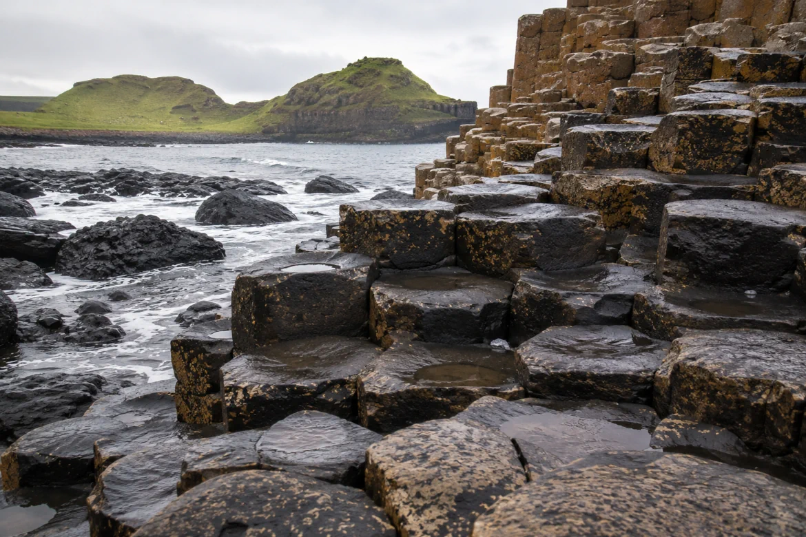
Perhaps the most famous example is the Giant’s Causeway. Although its remarkable hexagonal columns have inspired myths and legends for centuries, they actually formed around 60 million years ago, when lava cooled and contracted into thousands of interlocking basalt columns.
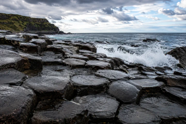
It serves as a reminder that Ireland’s landscape continued evolving long after its oldest rocks had formed.
Millions of Years of Change
After the great mountain-building events, Ireland entered long periods of erosion and quieter geological activity.
Rivers slowly carved valleys across the landscape. Layers of rock were worn away, exposing older formations beneath. New sediments accumulated in lakes, rivers, and shallow seas before eventually hardening into sandstone, shale, and other rocks that can still be seen today.
The island never remained the same for very long. Throughout its history, changing sea levels repeatedly flooded parts of Ireland before retreating again. Every stage left behind another chapter in the geological record.
This constant cycle of uplift, erosion, flooding, and deposition explains why Ireland contains such a wide variety of rock types despite its relatively small size.
The Ice Age Transformed the Landscape
While Ireland’s rocks are incredibly ancient, many of its most familiar landscapes are surprisingly young.
During the last Ice Age, which reached its greatest extent around 26,000 years ago, enormous ice sheets covered almost the entire island. In places, glaciers were more than a kilometre thick.
As the ice slowly moved across the land, it acted like giant sheets of sandpaper, grinding away rock, deepening valleys, smoothing hills, and carving out basins that later filled with water.
Many of Ireland’s lakes, U-shaped valleys, drumlins, and coastal inlets were created during this period. Even features that appear completely natural today often owe their shape to moving ice rather than rivers.

When the glaciers finally melted at the beginning of the Holocene, around 11,700 years ago, they left behind a transformed landscape filled with lakes, wetlands, fertile plains, and rolling hills.
Much of the scenery visitors admire today is therefore the combined result of hundreds of millions of years of geological activity followed by thousands of years of glacial sculpting.
When Ireland Became an Island
Although Ireland’s rocks are ancient, Ireland as an island is much younger.
For much of prehistory, lower sea levels connected Ireland to Great Britain through areas that are now beneath the Irish Sea. As global temperatures rose after the Ice Age, glaciers melted around the world and sea levels gradually increased.
Over thousands of years, these rising seas flooded the land bridge between Ireland and Great Britain. Between 10,000 and 8,000 years ago, Ireland had become fully separated, creating the island we know today.
The Atlantic Ocean has continued shaping Ireland ever since. Powerful waves constantly erode the coastline, forming dramatic cliffs, sea caves, natural arches, stacks, and sandy beaches.
Famous coastal landmarks such as the Cliffs of Moher, Slieve League, and many parts of the Wild Atlantic Way continue to evolve today as wind and waves slowly reshape the coastline.
The First People Arrived
By the time humans reached the island of Ireland, nature had already spent nearly two billion years creating the island.
The earliest known evidence of human activity dates to around 10,500 years ago, when hunter-gatherers arrived, most likely by boat. These early communities relied on fishing, hunting wild animals, gathering plants, and making the most of Ireland’s rich coastal environment.
Thousands of years later, farming spread across the island, transforming forests into fields and giving rise to permanent settlements.
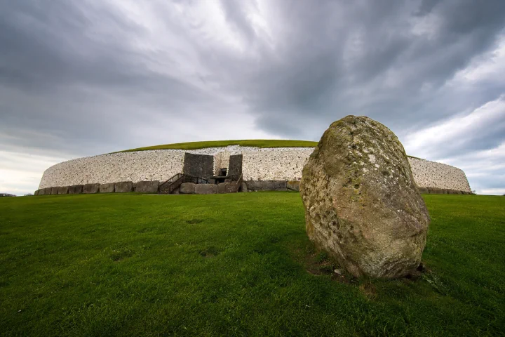
Ireland’s prehistoric people built remarkable monuments that still survive today. Passage tombs such as Newgrange, impressive stone circles, standing stones, and ancient hill forts demonstrate that the island’s human history is every bit as fascinating as its geological story.
Why the Island of Ireland’s Geological Story Matters
Understanding the island of Ireland’s age adds another dimension to every journey.
A quiet walk along a beach may take you across rocks that formed hundreds of millions of years before dinosaurs existed. A drive through the countryside passes landscapes that once lay beneath tropical seas before being buried beneath enormous glaciers. Mountain views become even more impressive when you realise they are the worn remains of ancient ranges created by continental collisions.
You don’t need to be a geologist to appreciate this story. Simply travelling around the island of Ireland means exploring one of Europe’s most fascinating natural timelines, where nearly every cliff, valley, and rocky outcrop reveals another chapter in its extraordinary past.
Planning Your Ireland Adventure
Exploring the island of Ireland is much easier when you organise the essentials before you travel. Expedia makes it simple to compare flights, while Direct Ferries offers routes connecting Ireland with Great Britain and mainland Europe. Hotels.com provides accommodation ranging from budget-friendly guesthouses to luxury hotels.
If you’re planning to explore beyond Dublin, renting a car gives you the freedom to discover places like the Wild Atlantic Way, the Ring of Kerry, or the Causeway Coastal Route at your own pace. Discover Cars lets you compare rental options from multiple providers in one place.
To learn more about Ireland’s landscapes and history, GetYourGuide offers guided tours, attraction tickets, and day trips across the island. If you’re still deciding where to stay, Stay22 allows you to compare accommodation on an interactive map, making it easier to choose a base close to the places you want to visit.
Whether you’re fascinated by geology, history, wildlife, or breathtaking scenery, every journey across the island of Ireland is also a journey through almost 1.7 billion years of Earth’s history.